Hiking Slaettaratindur
Want to hike to the top of the world? Well, you can, and honestly it isn't that hard...
Distance: 3-4 miles
Difficulty: Moderate, can be steep at times
Time: 2.5-3 hours
Slaettaratindur stands prominently 880 meters above the ocean, which you can see all around you from the top. It is impressive to look out into the vast expanse and see almost every island around you. I think this is rare, but both times I have been on top of the mountain, there has been almost NO wind. So much so that I've flown my drone there on top twice. I hiked the mountain once in the end of April, at which point there was still snow, and once in July, which was quite pleasant. Here's how:
Getting to the start of the hike to Slaettaratindur may seem confusing at first, but it's actually very easy to find it. If you're in Torshavn, start by driving towards Eidi. When you come to the Faroe Islands you should download the entire map of the islands in Google Maps. Once these are downloaded, you can easily get around to major landmarks, and, also, there are like 3 roads.
If you look at the rest of the pictures in this review, you can’t miss the parking area. You can google maps search “Eidi” and once you get there just keep following the road right.
So to start, put in 'Slaettaratindur' into your maps. It will take you to the mountain and coming from Torshavn, you will drive towards Eidi, transfer to a one lane, zig zagging road, that eventually leads to a pass. On the right are four peaks and on the left are two peaks. The left is Slaettaratindur. You will eventually come to the top of the pass and on the left side of the road is a small parking area that is fenced in, with a ladder that enables one to climb over the fence. This is where you should start the hike.
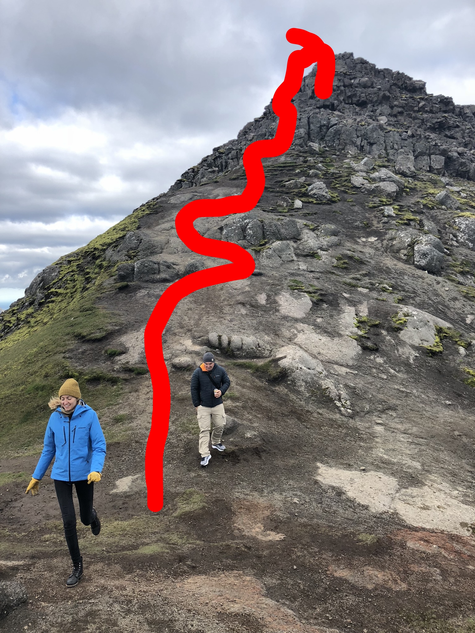
As you start the hike, you may or may not notice that it looks like you should go directly up the side of the grassy mountain. You would be correct. In the summer a path will probably be obvious since it is traversed quite often, but this might not be so in the winter. If it isn't obvious just do this: Look in front of you at the two high points, and walk up the mountain to the left highpoint. As you make your way up, you will a wooden stake in the ground, at which point you should turn to the left and snake around to the back side of the mountain. I'll illustrate this below.
Once you get closer to the top, your hike will become a bit of a scramble, but none of it is that difficult. You can honestly create your own path by simply taking the next easiest step, but chances are the path will jump out at you. You will soon come to a vast, flat topped peak.
Being on top almost feels like a different planet. It is above everything else (they say you can see ALL of the Faroe Islands from the top, and on a really clear day Iceland), and it is one of the most impressive places I've ever hiked. Spend some time to just relax and take in the views, and chances are the clouds will come rolling by you.
So that's it in a nutshell! Honestly, finding the parking area is one of the hardest parts. After that, just follow your sight to the top! Please comment below if you'd like any additional information, I'm happy to help!


